


N5 Net Software Repository
Your one-stop for all your software needs.
Search N5 Net Software Repository:
Search Files
Sponsor:
Browse:
- Audio & Multimedia (1621)
- Business (4269)
- Communications (1275)
- Desktop (188)
- Development (613)
- Education (177)
- Games & Entertainment (714)
- Graphic Apps (690)
- Home & Hobby (107)
- Network & Internet (577)
- Security & Privacy (529)
- Servers (65)
- System Utilities (11779)
- Web Development (292)
Areas Of Interest
Authors Area
Are you a software author? Take a look at our Author Resource Center where you will find marketing tools, software specifically created for promoting your software and a ton of other helpful resources.
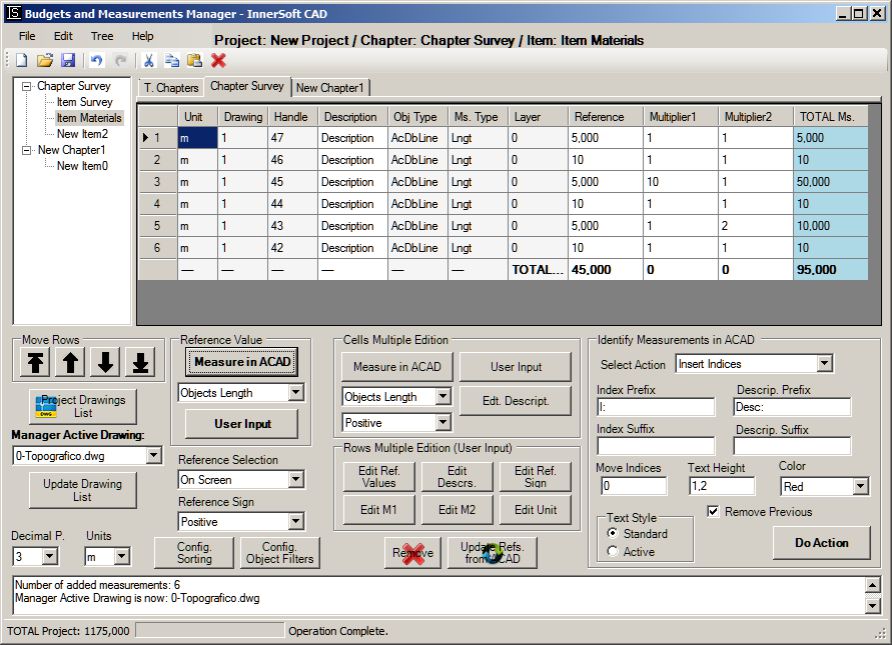
InnerSoft CAD for AutoCAD 2011 3.8
Graphic Apps :: CAD
(Click to Enlarge)
InnerSoft CAD is an plug-in for AutoCAD that installs a set of productivity tools for Civil and Survey, Counting, Estimating and measurements in construction project budgets. You can Export to an Excel Sheet the values of Area/Length property or coordinates for various AutoCAD entities; Import from an Excel Sheet the vertex coordinates for a set of 2D polylines or 3D polylines (you can choose between 3 different methods). You can also import a set of points from Excel or a set of Texts with an insertion point for each one; Extract all block definitions of a drawing in individual AutoCAD files (each block definition in a single file); Sum the area or length property of a set of objects. Sum accumulated distance of a user defined walk in the drawing; Draw the longitudinal profile of a terrain or set of surfaces. Triangulate a set of points or mesh a model surface; Take measurements on AutoCAD for construction project budgets; Create, open or save different libraries, which contain a series of AutoCAD drawings (*.dxf or *.dwg) organized by books; Draw a polyline graph, a 2D & 3D convex hull; lines, planes, circles and spheres by regression from a selection of points; clothoids, parabolas, circular transition curves, Wholly Transitional Curves, clothoid transition curves and parabolic vertical transitions.
Specifications:
Version: 3.8 |
Download
|

Similar Products:
::
 VeryPDF Mini EMF printer driver can convert any printable file into an Enhanced Metafiles (EMF). EMF format is a vector format, it can be inserted into other documents or viewed natively under Windows. Metafiles (EMF) are used primarily by applications that require further processing of the printed documents, such as extract ASCII text from EMF files or convert these EMF files to other formats again. Convert documents to metafile and EMF files.
Windows | Shareware
Read More
FOXPDF PDF CONVERTER ULTIMATE 5.0.1
Business :: Office Suites & Tools
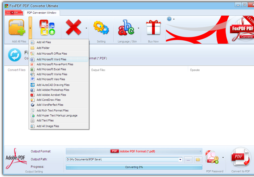 FoxPDF PDF Converter lets you convert Microsoft Office Word (DOC, DOCX), Microsoft Office Excel (XLS, XLSX), Microsoft Office PowerPoint (PPT, PPTX), Microsoft Office Visio (VSD), Microsoft Office Works (WDB, WPS, DOCX, XLSX), AutoCAD(DWG, DXF, DWF), CorelDraw(CDR), CorelPresentations(SHW), WordPerfect(WP5, WP6,WPD, WPF), WordStar(WS), DocuWorks(XDW), RTF, TXT, JPG, Bmp etc 500 Formats to PDF.
Windows | Shareware
Read More
EFM - ETECAD FILE MANAGER 2.19.1
Graphic Apps :: CAD
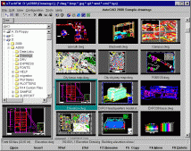 EFM is a Windows CAD graphics file manager and viewer all rolled in one. EFM completely replaces the Windows Explorer and provides additional features designed to handle CAD and image files.Not only does EFM allow you to view AutoCAD drawings, it can locate, retrieve, archive, convert DWG and PLT files and plot them too. You can attach descriptions to files and directories for easy identification as well as search for drawing files.
Windows | Shareware
Read More
TOPOGRAPHY IN AUTOCAD OR BRICSCAD 2.3
Graphic Apps :: CAD
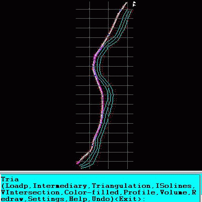 An add-on for AUTOCAD or BricsCAD, for the triangulation of a set of POINTS, isolines, DWG to Google Earth, the volume and center of gravity of a set of bodies or between surfaces composed of 3DFACE. You can load a file of points having the format: Number X Y Z Code. You can make cross sections, longitudinal profile and color-filled contour map. You can determine the flatness of the surfaces and you can import and export LandXML file type!
Windows | Data Only
Read More